Point of Interest
Fort Meductic / Meductic Indigenous Village
Street Address: Fort Meductic Road, Hay Settlement, NB
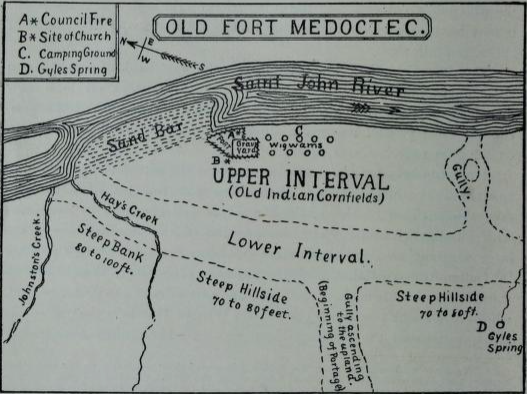
For untold ages, the Maliseet nation had gathered in spring on the broad intervale along the St John River near the mouth of the Eel River. Before it was flooded out by the construction of the Mactaquac Hydro Dam, the area was called Meductic Flat. When Europeans appeared in the early 1600s, they reported finding there a roughly rectangular stockade, constructed of logs bound together with spruce roots and supported by earth and rocks, the whole being surrounded by a defensive trench. Within the stockade was a long house, where councils were held, and facilities for storing provisions. A short distance from the stockade was the village proper. Archaeological excavations of the site occurred in the 1960s. A Historic Sites and Monuments Board of Canada plaque is located nearby along the Trans-Canada Highway.
Historical Map of Fort Meductic

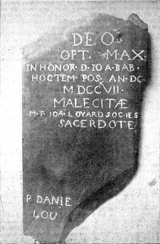
Meductic Church Cornerstone (1717). Oldest Christian religious artifact in New Brunswick, discovered 1890.
